
Freshwater coastal wetlands: Mexico's forgotten allies against climate change that are now at risk from livestock and agriculture.


Mexico
With more than 11,000 kilometers of coastline, access to two oceans, two gigantic peninsulas, and more than 4,000 islands, reefs, and cays, Mexico has a substantial coastal arsenal to confront climate change.
Freshwater coastal wetlands also have large trees that withstand flooding.
Photo: Patricia Moreno-Casasola, Institute of Ecology AC
In Mexico, a significant portion of freshwater coastal wetlands are distributed along the Gulf of Mexico coast, from the states of Tamaulipas in the north to Yucatán in the southeast. There are two types of wetlands.
On one side are the herbaceous wetlands, locally known as tulares or popales, depending on the predominant species. Both tule (Typha domingensis) and popal (Thalia geniculata) are perennial plants—which can live for more than two years—that rarely exceed three meters in height and are distributed horizontally, marking the landscape in a similar way to grasses. Due to their resilience, their thick leaves are commonly used by local communities to weave baskets, chairs, and other household utensils, or even for construction.
On the other hand, floodplain forests are areas where the vegetation includes tall, leafy trees such as the sapote (Pachira aquatica), the anona (Annona glabra), the willow (Salix humboldtiana), the fig (Ficus insipida), and the coyol (Attalea butyraceae). Unlike mangroves, floodplain forests have greater diversity. This is because only four species of mangrove are found in Mexico, and they tolerate high salinity waters. In contrast, more species are tolerant of freshwater.
“Freshwater coastal wetlands (herbaceous and floodplain forests) are adjacent to mangroves, but they are less influenced by seawater, and only in very large floods does their salinity increase slightly. However, they form a continuum along the coast and are as efficient at capturing carbon as mangroves,” explains Dr. Moreno, an emeritus researcher and one of Mexico's leading experts on coastal wetlands.
There is great variability in the carbon sequestration capacity of coastal ecosystems, which depends on factors such as surface area, the number of plant species, their conservation status, and the phase of the hydrological cycle—the period in which they are flooded. Therefore, it is not possible to make absolute comparisons between ecosystems. "There are productive and poor mangroves, just as there are wetlands."
However, current measurements provide an idea of the ranges for each species. In the Boquilla de Oro and La Mancha regions of Veracruz, floodplain forests have been found to capture up to twice as much carbon (869 tons per hectare) as adjacent mangroves (482), while herbaceous wetlands capture 692, according to comparisons made by Moreno.
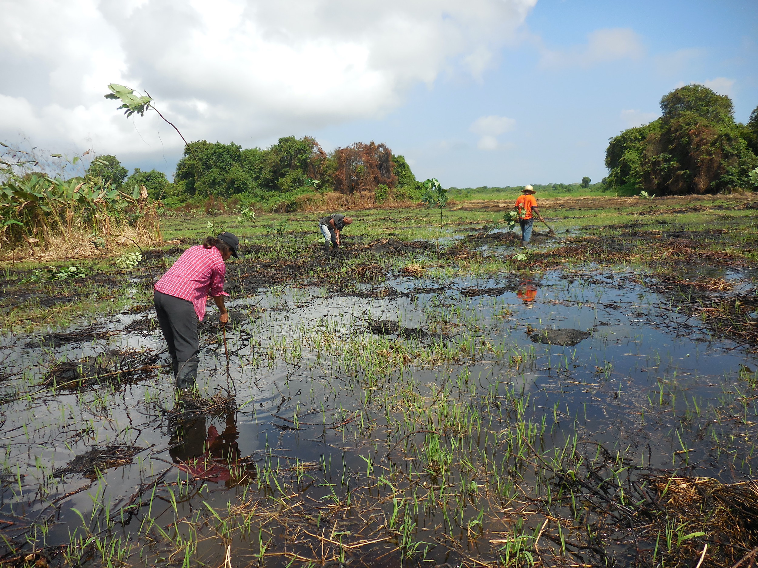
Communities in Veracruz, Mexico, are working to restore freshwater coastal wetlands.
Photo: Patricia Moreno-Casasola, Institute of Ecology AC
This difference is even more dramatic on the coast of the neighboring state of Tabasco, where the Pantanos de Centla Biosphere Reserve can capture up to 3,063 tons of carbon dioxide in its floodplain forests, 1,103 in its grassy wetlands, while storing 829 in its mangroves.
In addition, floodplain forests and grassy wetlands can capture up to seven times their volume in water, helping to contain flooding, protect against seawater incursions, and serve as a source of water for wells.
Despite this potential, freshwater coastal wetlands are not included in the “blue carbon” category, which is primarily used for coastal ecosystems such as mangroves and seagrass beds.
“I think floodplain forests are the most threatened ecosystem in the country, because they are only flooded three or four months a year and are the first to be demolished by people for their activities, while mangroves have at least benefited from an aligned conservation policy,” explains biologist Moreno Casasola, who adds that these ecosystems are also seriously affected by the alteration in the natural flow of rivers and streams and the pollution that comes with them, which includes everything from agrochemicals to hormones.
The available area of freshwater coastal wetlands has historically decreased and continues to decline, primarily due to habitat loss caused by land use changes for agricultural activities.
This problem is exacerbated by the lack of reliable records, since "unfortunately, these ecosystems are not accounted for by most countries," explains Patricia Moreno.
The expert perceives an invisibility of these ecosystems compared to others like mangroves, which could be attributed to a historical lack of understanding. "For example, many hydraulic engineers still call tulares and popales 'aquatic weeds' because historically, drainage channels drained into these misunderstood ecosystems in many parts of the country, and as a result, they became severely degraded," Moreno recalls.
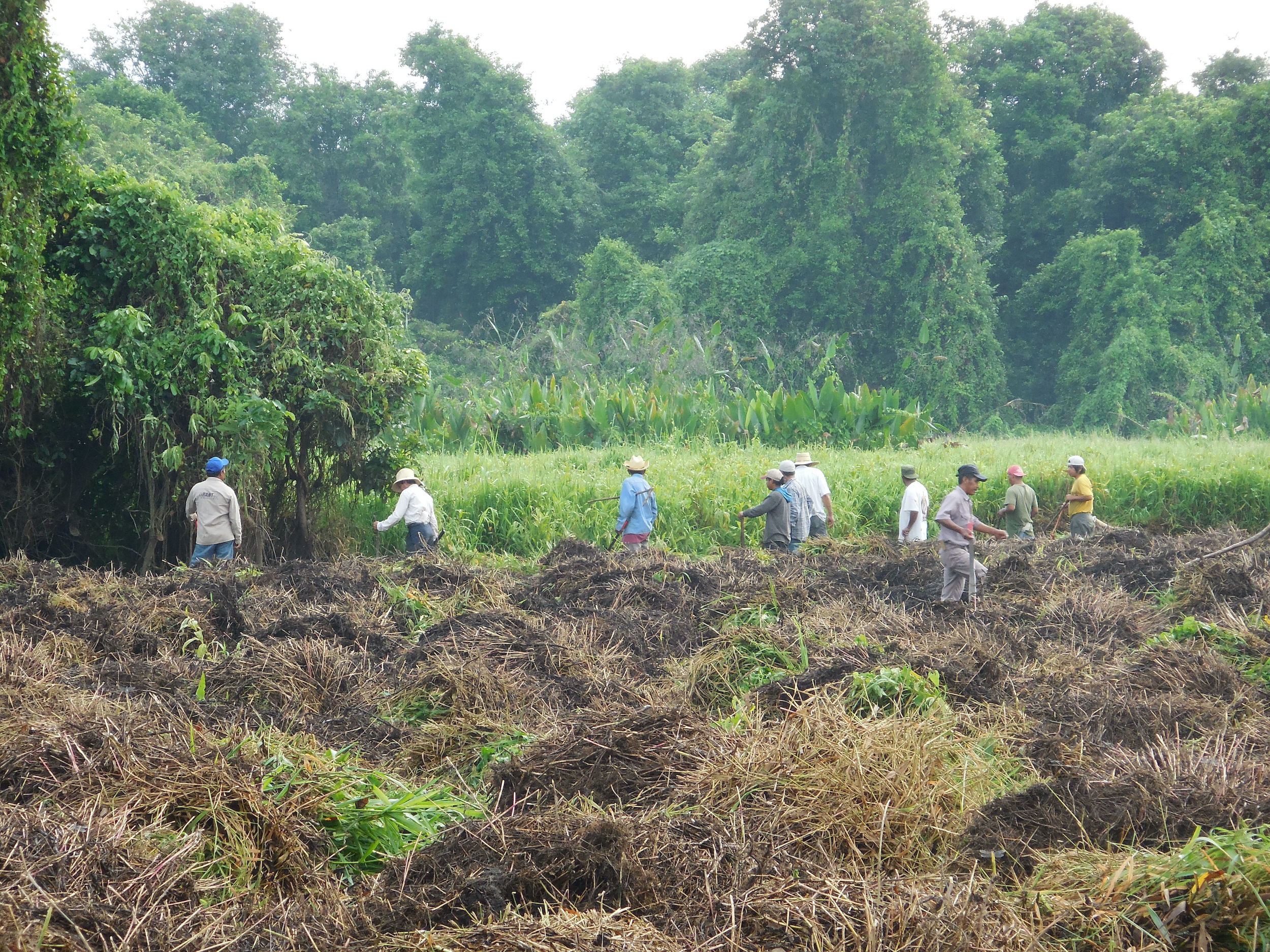
Communities in Veracruz, Mexico, are working to restore freshwater coastal wetlands.
Photo: Patricia Moreno-Casasola, Institute of Ecology AC
Other reasons for the invisibility of these wetlands, according to the researcher, are institutional and methodological. First, because responsibility for the country's wetlands has legally fallen on the National Water Commission (Conagua) since 1992, which actually focuses more on delivering drinking water and collecting wastewater from communities than on researching and conserving ecosystem diversity. Second, the methodology used by the National Biodiversity Commission (Conabio), created at a time of strong push for mangrove conservation, often conflates freshwater wetlands with mangroves, which is reflected in the available maps and data, she says.
"The only way to separate them (into different categories) is through fieldwork in each location, and this is very costly and time-consuming," says Moreno, explaining that this has made it impossible to have a truly reliable map of wetlands in Mexico, nor to distinguish between the ecosystem contributions of each type of wetland.
Veracruz is the state with the longest coastline on the Gulf of Mexico. A 745-kilometer stretch of coastline is home to dunes, lagoons, freshwater wetlands, mangroves, seagrass beds, and coral reefs. In this ecosystem mosaic, freshwater wetlands are found both in the form of grasslands (tulares and popales) and floodplain forests.
Of its nearly 7.2 million hectares, Veracruz allocates at least 4.2 million (58% of the total) to agricultural and livestock activities, according to official figures. This area is divided between the production of more than 120 crops and cattle breeding, primarily cattle, which, according to the latest Agricultural Census, generates 2.7 million head of cattle annually on nearly 3.3 million hectares, equivalent to almost 46% of the state's total land area.
This has led to Veracruz remaining the leading beef producer in Mexico for at least a decade, according to official data. In other words, this state, with a surface area similar to that of Panama, allocates almost half of its territory to cattle ranching.
In this context, coastal wetlands face the constant risk of being destroyed to allow livestock and crops to be planted, according to specialists and residents of these regions.
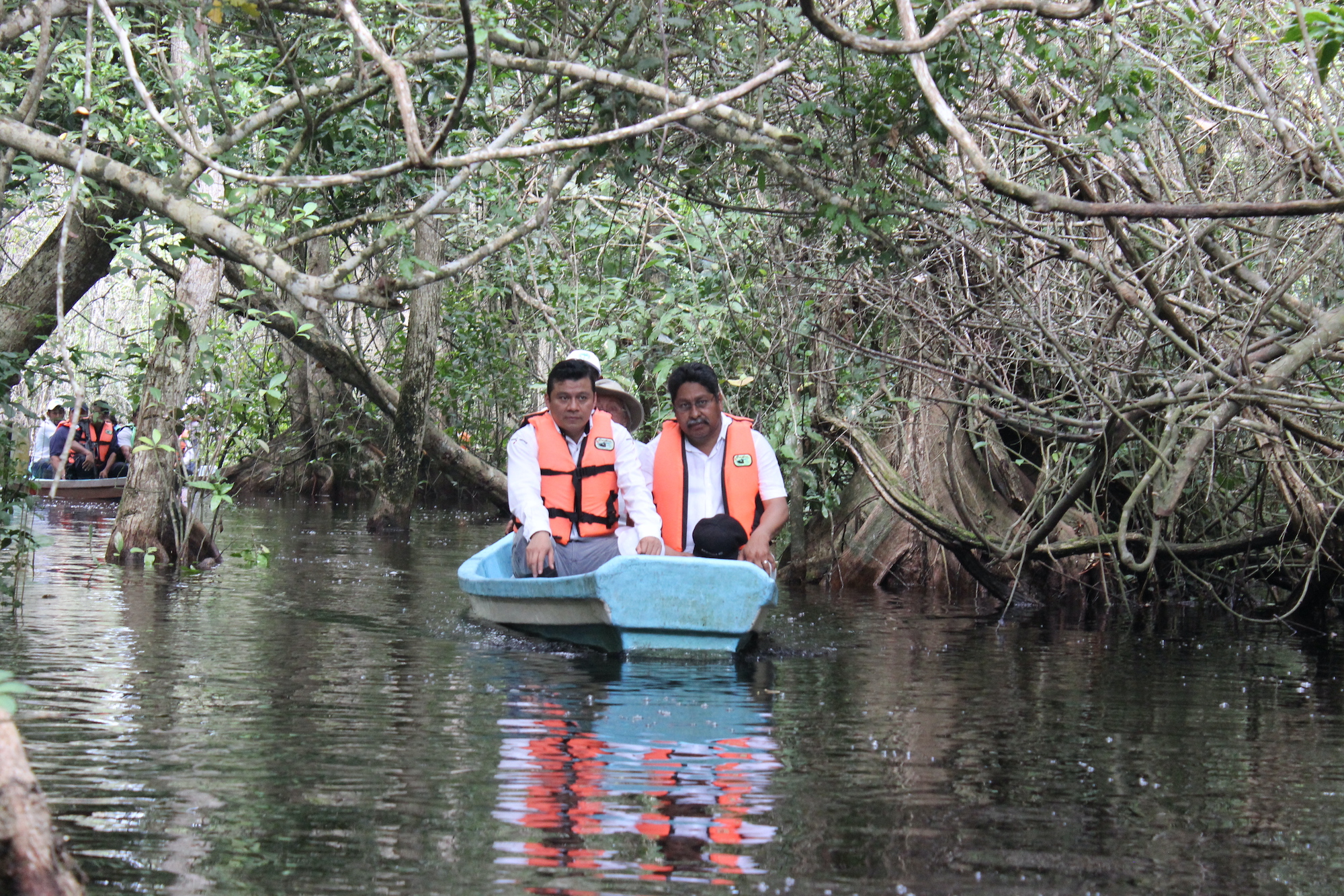
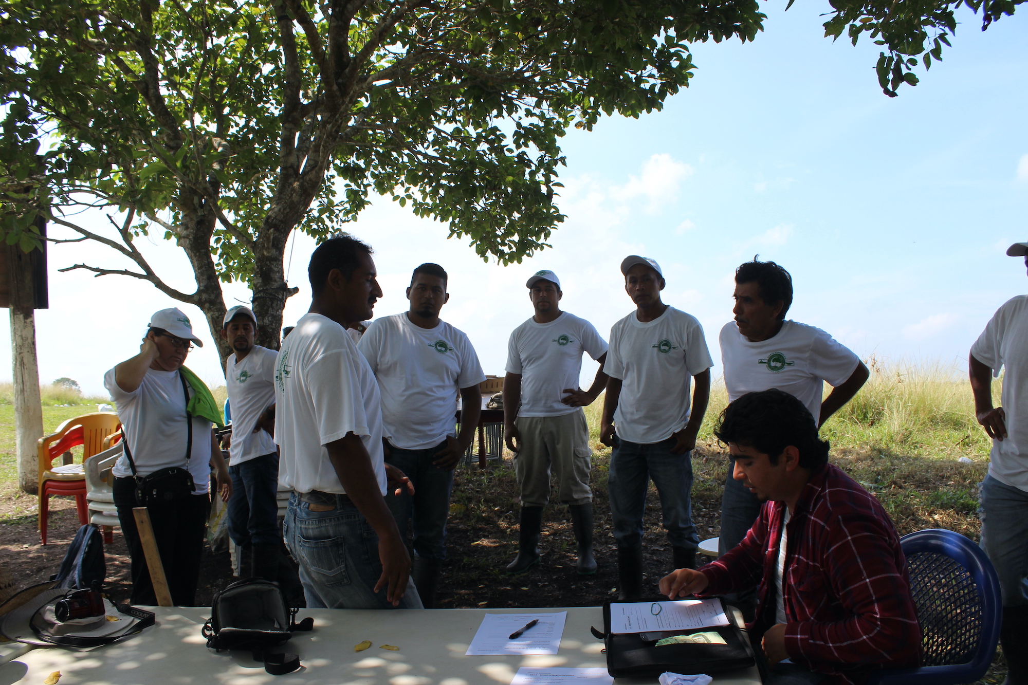
Wildlife monitoring supervised by Inecol researchers.
Photo: Patricia Moreno-Casasola, Institute of Ecology AC
“Although a wetland develops plants that help retain water, filter air, capture carbon, and provide habitat for many other species, it is more profitable for local people to convert it into a pasture,” explains David Díaz, a farmer and ecotourism guide in the La Mancha region of Veracruz.
This land-use change has already occurred countless times in this Mexican state, and the methodology is simple: using heavy machinery or even picks and shovels, trenches are dug in the ground to drain accumulated water, until the wetlands are completely dry. Commercial species such as German grass (Echinocloa pyramidalis) are then introduced, which will later serve as fodder for cattle or goats, Díaz explains.
"Pastures are more profitable precisely because there's enough moisture on those lands, and you can keep cattle almost year-round," says the farmer-turned-conservationist.
The tension between wetlands and agricultural activities has particularly marked the history of Ciénaga del Fuerte, a 4,274-hectare state park located in a tourist area of Veracruz known as Costa Esmeralda, amidst pastures, crops, and a beach with hotels, in the Ricardo Flores Magón community, Tecolutla municipality.
Originally a dense, unowned wetland, people had freely fished shrimp and acamaya (prawns, usually of the Macrobrachium acanthurus species) there since the 1950s. Back then, production was plentiful, and it was profitable to be a fisherman, explains Guillermo Marín, a member of the Río Soteros SC de RL Cooperative Society for Fisheries Production and Services, which currently manages both production and conservation activities in the wetland.
In the late 1980s, the area fell under the scrutiny of developmentalist policies when state politicians, with the support of local peasants, began organizing the formation of an ejido (common land). This is a unit of social land ownership and agricultural productivity created by the peasant revolution at the beginning of the 20th century and which, together with agrarian communities, covers almost 60% of the land in Mexico, mainly in rural areas.
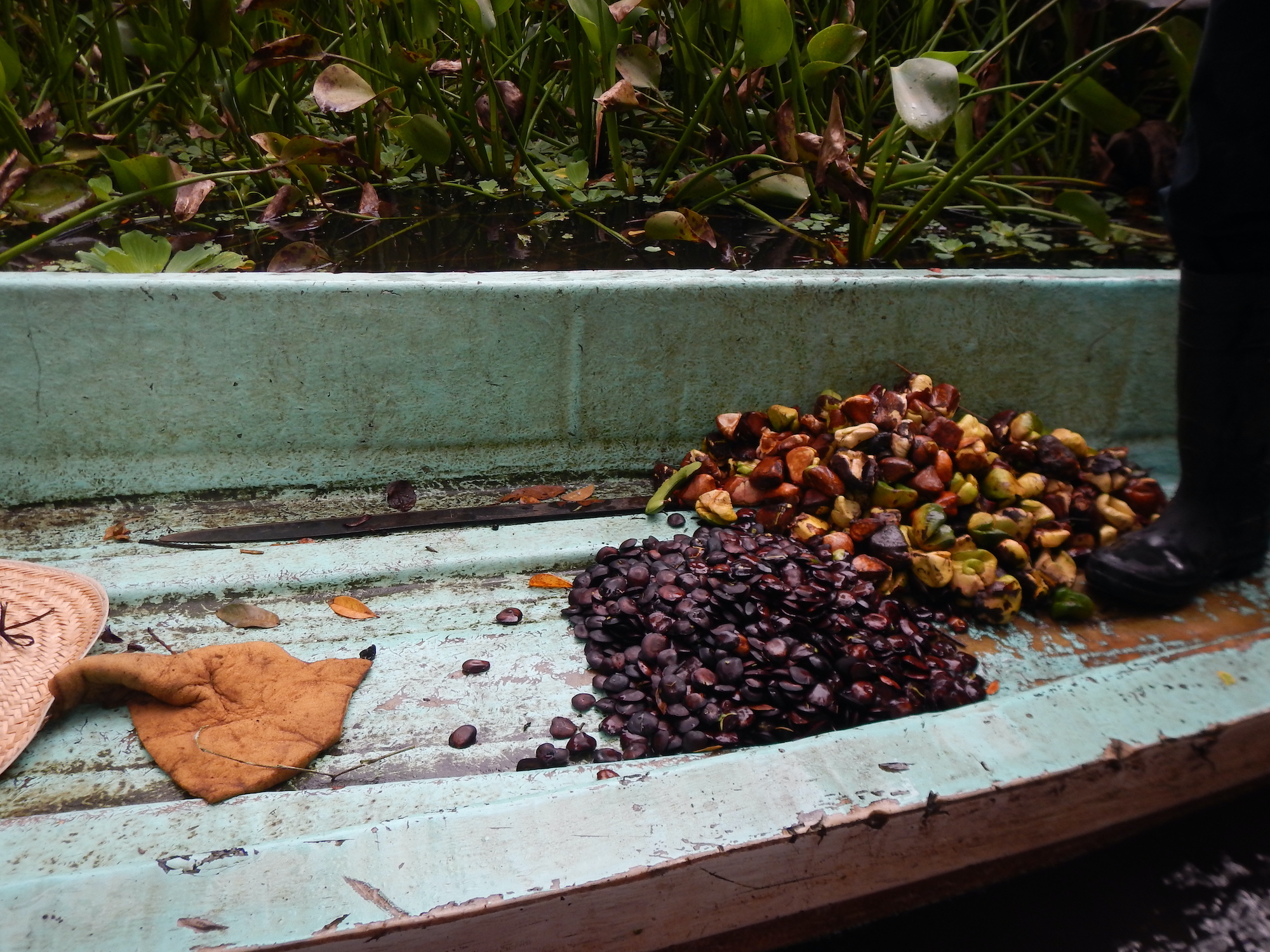
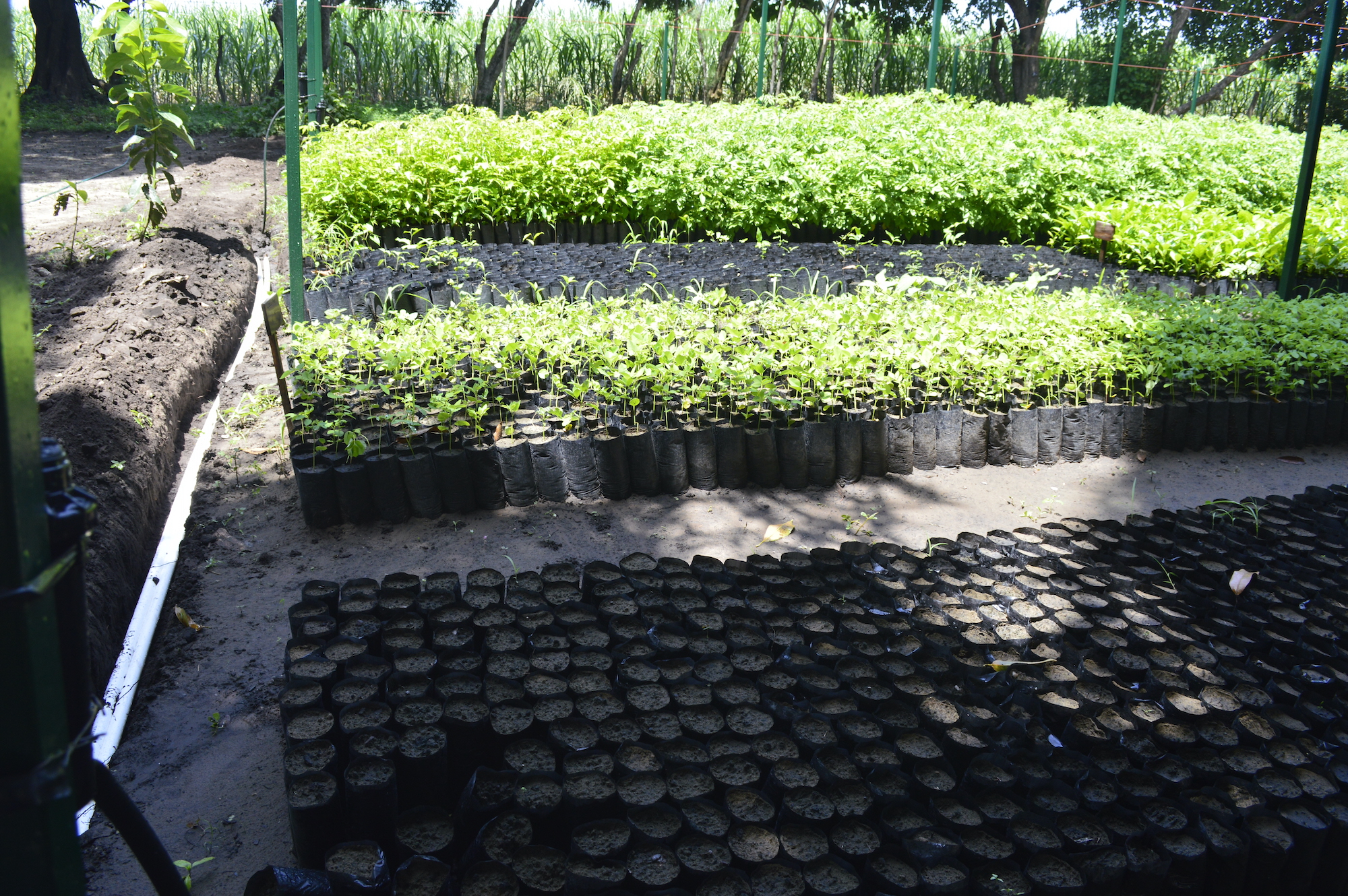
Collecting seeds to reproduce them in a nursery and thus have plants to sow.
Photo: Patricia Moreno-Casasola, Institute of Ecology AC
“The problems began in the mid-nineties because when they (the farmers) began to subdivide land, they would take away the shrimp traps that we fishermen with permits had,” says Guillermo Marín.
Faced with the attempt to create an ejido (common land), which risked destroying the wetland to divide the territory into plots dedicated to agriculture and livestock, Marín and his fellow fishermen sought support from municipal authorities and federal agencies such as the Ministry of the Environment (Semarnat), the Federal Attorney's Office for Environmental Protection (Profepa), the National Water Commission (Conagua), and the National Fisheries Commission (Conapesca). Finally, on November 26, 1999, the park was designated a state park, granting it state protection. By 2002, the fishermen had consolidated their position as the current Río Soteros cooperative, hoping to have greater influence on legal proceedings.
Scientists, farmers, and fishermen worked hand in hand, and their research revealed the site's immense potential for filtering water, providing habitat for species, and capturing carbon. Among these scientists were biologist Abraham Juárez Eusebio and Dr. Patricia Moreno Casasola.
The scientific results guided the fishermen toward a new direction to preserve the wetland: ecotourism.
“People from the state Environment Secretariat and several scientists told us that if we wanted to continue in that area, we had no choice but to become environmentalists,” Guillermo Marín recalls. “They supported and trained us, but they also asked us to change our practices so that the fishing and hunting that were carried out back then would no longer affect the wildlife.”
The attempt to create a common land ceased, and the new conservation space began to flourish. Almost two decades after that, Ciénaga del Fuerte State Park boasts nearly 1,033 hectares of floodplain forest, 975 hectares of herbaceous wetlands, and nearly 118 hectares of mangroves—with endangered mangrove species such as Rhizophora mangle, Avicennia germinans, and Laguncularia racemosa—where trees over 300 years old survive. This area offers visitors, approximately 1,600 each year, the opportunity to reconnect with nature through canoeing tours, lectures, and wildlife viewing.
In early August, Veracruz's new environment secretary, Luz Mariela Zaleta, presented a team to the Tecolutla city council that will work on developing a management plan for the Ciénaga del Fuert State Park. The plan seeks to harmonize the protected area's resource utilization needs with those of conservation.
freshwater coastal wetlands in Veracruz, Mexico.
Photo: Patricia Moreno-Casasola, Institute of Ecology AC
Just over 100 kilometers south of Veracruz, in the La Mancha region, a group of farmers and environmentalists have taken a different approach to preserving their freshwater wetlands.
Unlike Ciénaga del Fuerte, there wasn't much left to conserve there, as the removal of vegetation for cattle ranching that began decades earlier left David Díaz and his companions with a landscape of pastures.
With the support of scientists from the National Institute of Ecology, including biologist Patricia Moreno, who raised awareness about the importance of wetlands, the restoration of the original wetland on the site was designed in 1998, and work began to make this design a reality.
But the beginning was uphill, Díaz recalls.
“The cattle pasture was removed, native plants were introduced, weeds were cut and burned, and chemicals were applied, but almost none of it worked until a biologist came up with the idea of putting up shade netting,” explains the farmer, who is also a member of the ecotourism company La Mancha en Movimiento.
Shade netting, commonly used in agriculture and gardening to reduce plant exposure to the sun, prevented exotic grasses from developing and replaced them with the original tules and popales. After these herbaceous plants were dispersed and the environment adapted, shrubs and flood-resistant trees, including apompo, anona, cork trees, willows, and ficus, were reintroduced, Díaz describes.
"These plants and trees began to form the conditions of what was once, a long time ago, a floodable forest," the eco-guide says. "Then we realized that through this process, fauna such as turtles, crocodiles, fish, shrimp, and birds began to arrive," which they detected through wildlife monitoring supervised by Inecol researchers. These findings highlight more than 200 species of birds, including aquatic, wading, and terrestrial birds, including some endangered species like the reddish egret (Egretta rufescens) or threatened species like the great egret (Ardea alba) and the golden-toed heron (Egretta thula).
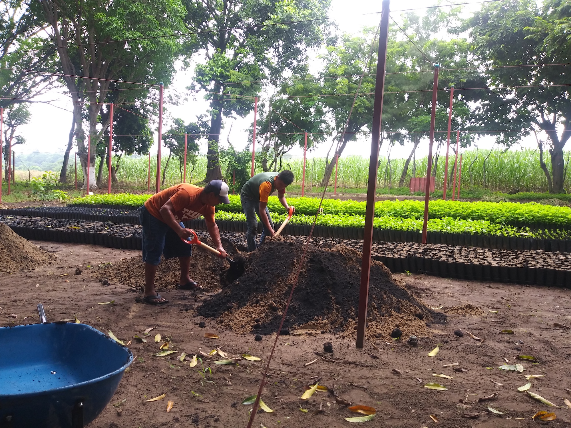
Nursery in Veracruz, Mexico.
Photo: Ecoguides La Mancha
While this conversion is a modest experiment given its area—just under 5 hectares—it represents a testament to the collaborative work between scientists and communities to reverse environmental degradation and an opportunity to "revalue what nature and its ecosystem services offer," says Díaz.
The restored former pasture now houses the Ecoguías La Mancha camp, the base for the ecotourism operations of this fishing company converted to low-impact activities. There, tourists can choose between birdwatching, horseback riding through coastal dunes, observing the nocturnal habits of wildlife, or simply participating in rural activities such as milking cows.
Some of these activities take place in nearby areas, such as El Farallón Lagoon or the Cansaburro Reserve, which also contain mangroves and coastal wetlands covering an area greater than 100 hectares.
In addition to tourism, the Ecoguías La Mancha camp offers environmental education workshops for children from nearby communities and supports field research by Inecol scientists. The company also experiments with productive activities such as stingless bee honey and the use of local biomass for livestock feed.
“This space is very important to us because it allows us to demonstrate to people the importance of a freshwater wetland, the ecosystem services it provides, and how they should be maintained without having to be transformed. This will provide us with a benefit that apparently won't provide us with any economic input, but will provide us with even more environmental benefits,” says David Díaz.
While continuing their conservation experiment anchored in ecotourism, Díaz and his companions supplement their income with traditional activities such as fishing (extracting oysters, clams, and finfish), agricultural production of corn, peanuts, squash, and sugarcane, and some livestock farming. The constant challenge is to maintain these activities at a level compatible with the wetland, always under sustainable use.
Ecoguides of La Mancha working in their nursery.
Photo: Ecoguides La Mancha
In both Ciénaga del Fuerte and La Mancha, it is evident, on the one hand, that wetland conservation and restoration activities are intensive in terms of human and financial resources.
"We lack support for maintenance," says Guillermo Marín, from Ciénaga del Fuerte, who highlights how his group has learned this hard lesson after losing much of the land reforested over the years due to a lack of financial support.
Maintenance involves clearing reforested areas of vines (Ipomoea tiliacea, Ipomoea indica, Dalbergia browneii), which can climb over the reintroduced trees and smother them before they reach a strong, secure age. Clearance also includes water channels, which can become saturated with floating plants such as lily pads (Eicchornea crasippes) and water lettuce (Pistia stratiotes), impeding the flow of water to the sea.
The work is partially carried out by the fishermen's cooperative, especially in the canals where tourist tours are conducted. But Guillermo Marín and his colleagues are overwhelmed by the growth of these plants and the amount of land they need to monitor. Added to this is the fact that reforestation funding, which for almost two decades came from various federal government entities or private actors, such as the Zícaro Foundation, stopped flowing with the same intensity after the COVID-19 pandemic.
“We realized it wasn't just about planting or reforesting. Maintenance is very important given the current problems facing the rainforest, as there are many places where morning glory (a genus of plants common in tropical areas of the planet, mainly vines) are overtaking the trees,” says Marín, who adds that since 2019, they have not been approved for any funding projects to continue their conservation work.
“The floodplain forest is losing the battle against these species,” he says.
Marín believes that to reverse this loss, reforestation projects must consider funding for at least five years of maintenance and monitoring, with at least two cleanup sessions per year, in April and August, when the forest is coming out of the flood season and the trees are covered with climbing plants.
Researchers who have supported the conservation and restoration processes in Ciénaga del Fuerte and La Mancha agree that, although community involvement is essential, the work is medium- and long-term and requires support from the authorities:
“Restoration is a process that takes many years and involves the people who live nearby. So, the trend is really toward restoring with the communities, not just arriving and planting plants,” explains Patricia Moreno, who highlights the recovery of the water flows that naturally feed the wetlands and restoring the salinity balance in the water as a crucial element of this work.
Communities and scientists work together in freshwater coastal wetlands in Veracruz, Mexico.
Photo: Patricia Moreno-Casasola, Institute of Ecology AC
In Ecoguías en Movimiento, the La Mancha group, the conclusion has been the same:
“We frequently clean the streams that flow into the lagoon, but within the mangrove area we only do one or two cleanings per year because it's a lot of ground to cover and requires a lot of time, wages, and also a lot of bags of garbage,” explains David Díaz of Ecoguías en Movimiento, who emphasizes that the expenses are entirely at his group's expense, as they have had no contact with the current state or municipal governments.
Mongabay Latam requested information from the Veracruz government about its financing and maintenance plans for the state's poplar forests, floodplain forests, and coastal wetlands, but has not yet received a response.
Ecoguías en Movimiento goes a step further, as in addition to directly working in ecosystems, it seeks to raise awareness in upstream communities to review the management of solid waste or the mining of construction materials, which, when rained on, channel trash or sediments that affect downstream wetlands.
Ecotourism revenue is the only source of funding for conservation activities, so the group is seeking to spread the word about its project.
"Let people know that the contribution they make by choosing a nature activity with us doesn't just go to a company's capital, but rather to the capital of the environment and to education about the importance of conservation for the development of the region," says Díaz.
For researcher Patricia Moreno, it is clear that the visibility and funding of coastal wetlands must begin with Mexican authorities at the highest level, in coordination with current global efforts.
"The important thing is that authorities, especially federal ones, realize that freshwater wetlands also capture a lot of carbon. And if we truly include them, as is being done with mangroves, we would have much stronger international participation in the fight against climate change."
(*) This article is part of a collaborative special between Mongabay Latam, EL TIEMPO, La Barra Espaciadora and Runrun.es
eltiempo


